120
One of the BEST things we have received from Your Move so far has been our handy wayfinding package with professional access guide brochures and stencil art on the local pathways. We use these guides to show families our 4 recommended safe routes to school, as well as areas such as bike rack locations, entry points or areas where students need to be extra cautious.
I have made a brief video tutorial using Google Maps, which will walk you through how to plot your own routes to school and add symbols for other locations too.
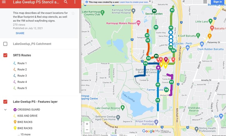
We also used this to show the Your Move team where we wanted them to paint our stencil art on the ground (by adding symbols). Google Maps even tells you how far the locations are from your school, which helps you tell them what to write on the signs!
Here is the link to the video:
And this is how our maps looked in the end when we sent it to be published:
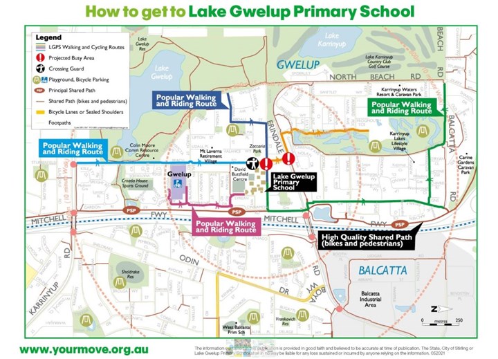
And this is how it looked when the professionals worked their magic on it & gave it to us as a digital + published brochure.
We highly recommend taking advantage of the wayfinding package if you get the chance!
This story is related to Map Safe Routes to School - Stencil Art (Advanced)
Discuss this story
2 Comments
Please login to comment
James (Your Move)
Thanks Joanna - love that video 😊!
Report comment