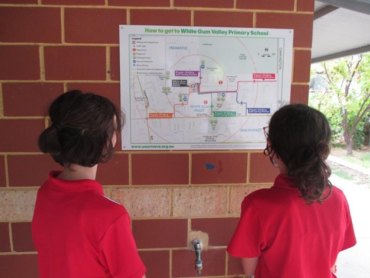
Over the summer holidays we had two signs made based on the map brochure that was developed by our 2021 Your Move Ambassadors.
The signs show paths to school across the suburb, helping riders and walkers plot safe courses. A legend includes key information such as popular walking and cycling routes, traffic lights, steep inclines, parks and drinking fountains, park and walk points and bicycle parking.
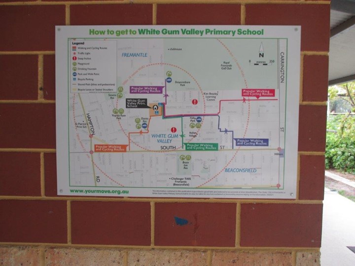
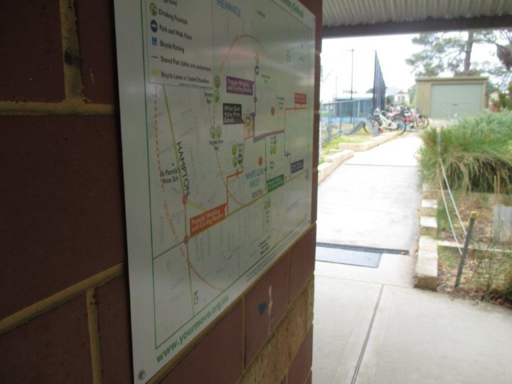
We decided to place our map signs close to the two areas where bikes are parked to help riders identify the various ways to travel school. As our school has lots of entry gates placing them in the very best spot was tricky!
Thank you to the Department of Transport for making it possible to turn our map into signs for our school walls.
This story is related to Complete a simple activity (2)
Discuss this story
1 Comments
Please login to comment
James (Your Move)
Great idea Nyanda! Was this idea something the student team came up with? It is the first time I have seen a story on making signs from the Access Guide so I have given you 15 "innovation" points on top of the 25 points for creating these signs and 10 points for sharing the details of what you did. Well done everyone!
Report comment